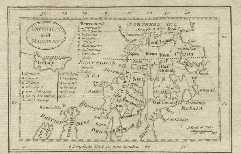
The seller of this map could not tell me much about it, except that it might have been done by Matthew Carey and that it was from around 1800. But when you have never seen something before,it is tempting to buy it as it might well be that you wont see it again. What I found interesting on the map is that Iceland is clearly based on the shape of Iceland introduced by Herman Moll. That awful shape would then have survived into the fourth generation of English cartographers, from Moll, to Bowen, to Kitchin to Carey.
Sweden and Norway
YEAR 1800
Technical data
Nordics
1800
Matthew Carey
6,9 x 10,6 cm.