This map, from Roscellis publication of Ptolemy’s Geography, is a typical Ptolemic map of Britain. Scotland stretches East, due to wrong coordinates being provided by Ptolemy. North-East os the island Thyle, the one who would be confused with Iceland. In this case, there is no doubt that they are not trying to show Iceland, but the island Pytheas claimed to have sailed to in the second century B.C.
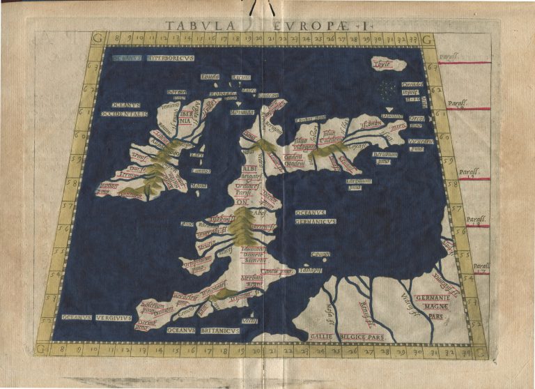
Tabula Europæ I
YEAR 1561
Technical data
Britain, Thyle
1561
Girolamo Ruscelli
18 x 25,3 cm.