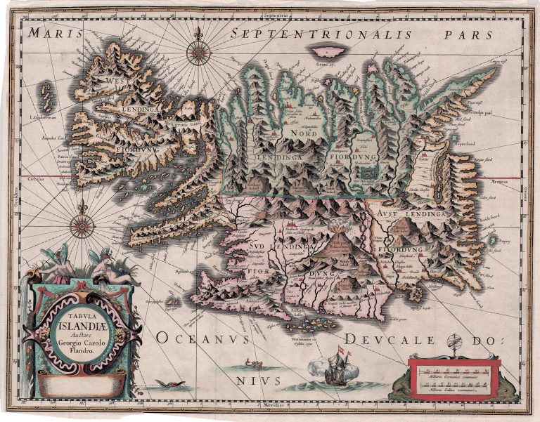
This map had been prepared by Jodocus Hondius Jr. for planned new atlas, when he died in 1629. When his widow sold the plates to the competitor, Willem Blaeu, Jodocus’ brother Heinricus and brother in law Jan Janssonius, copied the map to do their own. This is before the days of copyrights, as we know them today. It was published by Henricus in 1631 and Janssonius in 1638. The map looks to be the same, apart from the signature box being left empty. There are, however, slight differences in the way it is engraved, the most noticeable being perhaps the name of the island Grimsey. On the map of Jansonius/Henricus Hondius, the name of the island appears South of the island, but North of it on the original map, now in the hands of Blaeu. The plates of this map would later be used by a few other map publishers, first Moses Pitt.