This historical map illustrates the region involved in the conquest of Cyrus the Great (558-528 BC), the founder of the Persian Empire under the Achaemenid dynasty. It covers all of Asia Minor through to Armenia and Babylon. Three superb cartouches featuring putti adorn the map, which was compiled and drawn by Pierre Duval for Jansson’s historical atlas. Blank verso, published in Pieter de Hondt’s Description Exacte de l’Univers, ou l’Ancienne Geographie Sacree et Profane, a French edition of Georgius Hornius’ Accuratissima Orbis Antiqui Delineatio, which included maps from Johannes Jansson’s historical atlas and Abraham Ortelius’ Parergon. [from Oldworldauctions.com]
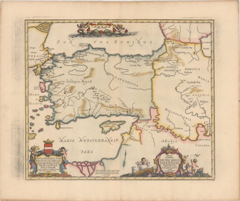
Tabula Itineris Decies Mille Graecorum sub Cyro Contra Fratrem suum Artaxerxem, Regem Persarum..
YEAR 1741
Technical data
Near East
1741
Pierre Duval
40,9 x 48,8 cm.