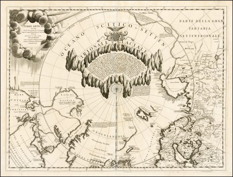
This map provides a remarkable depiction of the North Pole area. It is richly decorated, around the North Pole itself, but also with headwinds in the title shield. It also has a lot of information in text about early discoveries, for example the statement that Greenland was discovered by Henrico Rosso in 892; this is the Italian rendering of the name of Erik the Red or Eiríkur Rauði.
Iceland barely makes it onto the and is seemingly in the shape of Joris Carolos, which is the model Coronelli used for his maps of Iceland from the same time.