This map appeared in Pomponii Melae De orbis situ, libri III. et C. Iulii Solini, Polyhistor, published by Henri Petri, in Basel in 1576. Mela and Solinus were Roman scholars and Iceland had of course not been discovered in their time. However, the island Thyle or Thule had been. The story is like thus:
A man called Pytheas lived in Marseille in the fourth century BC, which at the time was a Greek colony. He was a geographer and a mathematician and is credited to have made the oldest known geographical coordinate measurements; he calculated the location of his hometown. He was also an explorer. He travelled to Britain and from there sailed for six days in a northerly direction and came to a land which he called Tule. Unfortunately, all accounts of this voyage come to us through other writers, the original being lost. The accounts differ, but what seems to be known at a minimum is that this country was
inhabited. Churchill called Pytheas the greatest explorer of all times. Strabo, the Greek historian and geographer who lived around the time of Christ, labelled him simply as a liar. Iceland’s association with Tule helped make Iceland perhaps the most mythical place that ever actually existed.
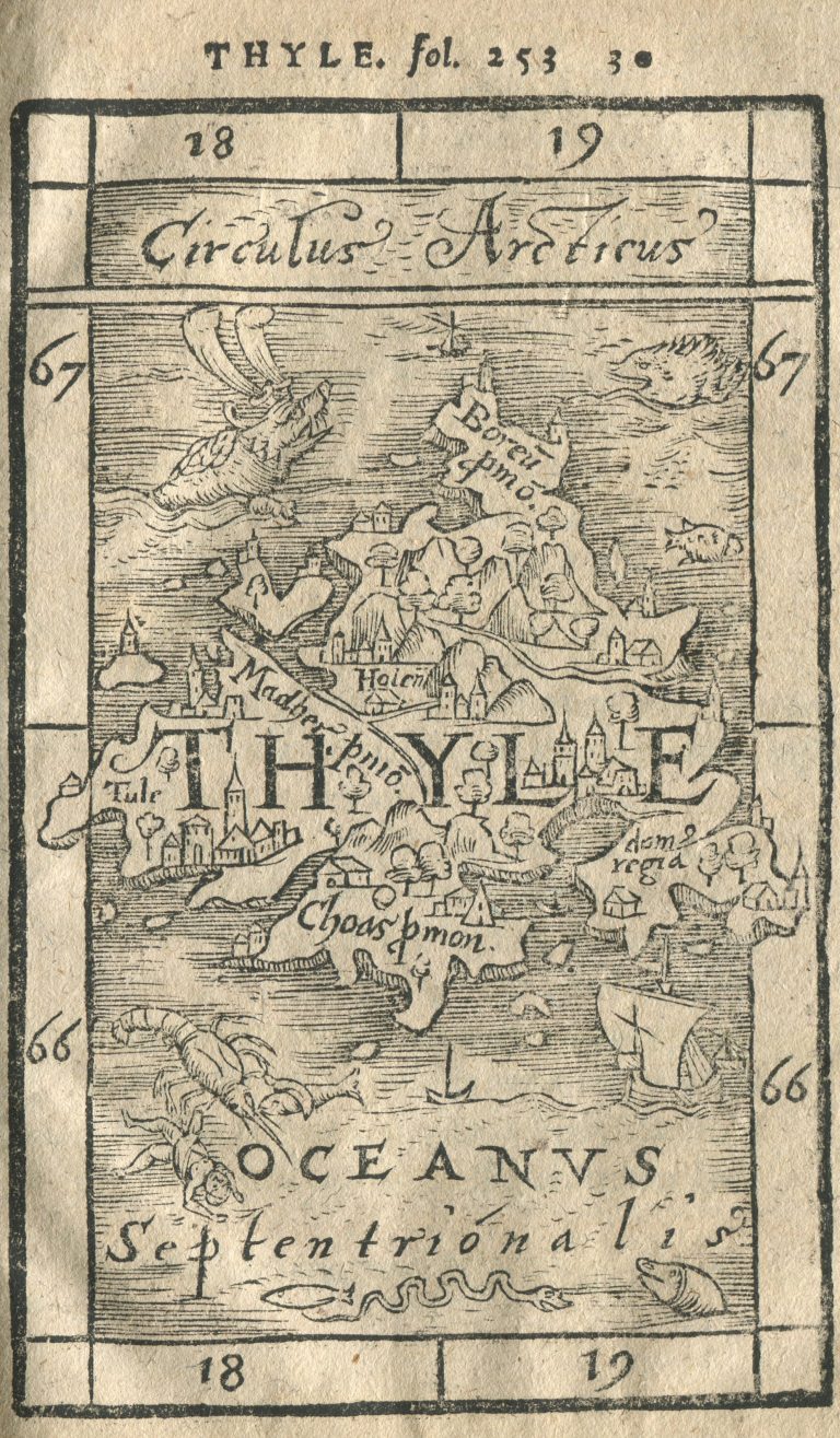
The map is depicting the Thule of Pytheas, which we know was not Iceland; it would be in the wrong place and not settled until much later. But in the late middle ages there was much confusion about this. The map shows Thyle between 66 and 67°North, which could well be Iceland, but between 18 and 19° East, which could definitely not be Iceland, even if the Prime Meridian was not fixed at the time. What makes me include this map is the place name Holen, which was a common way to label Hólar, the bishopric in the North of Iceland. Another place name is Choas, which likely comes from Chaos, a label which Olaus Magnus gave places in Iceland in his Carta Marina and later in the History of the Nordic Peoples. The map is clearly to some extent showing Iceland, it is a hybrid. This is inlike the case with Frisland of Antonio Lafreri in 1558, which is just showing a fictional place.
