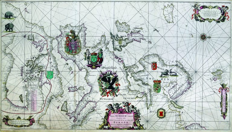
This is De Wit’s famous chart of Europe, based on Blaeu’s map from 1621. It shows all the coast of Europe, with the Eastern Mediterranean moved into Africa’s interior, to accommodate it.
After the death of De Wit the plates were bought by Louis (Luis) Renard, who issued them with his own text. On the later issues, the coats of arms have been removed. Reiner and Joshua Ottens re-issued Renard’s atlas in 1739 with a French text, and again in 1745 with a Dutch text and their names added to the plates for the first time. Finally, in 1802, the widow of G.Hulst van Keulen, publishedended the long and distinguished career of this plate, and in a way, that of Blaeu’s 1621 map.