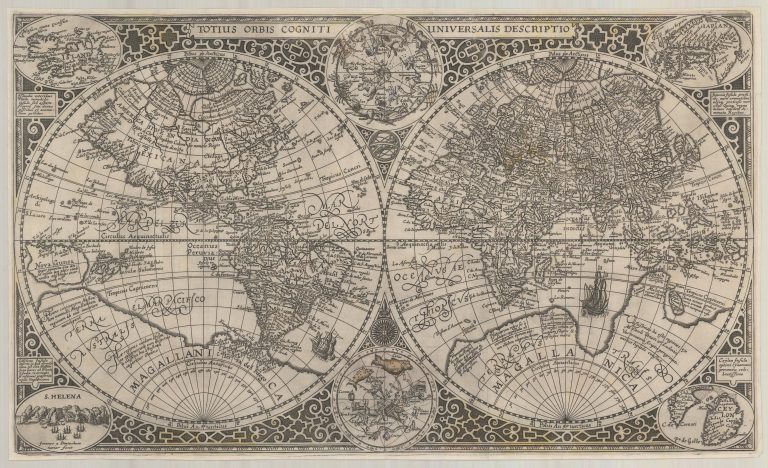
This is a nice World map in itself, but of particular interest for me is the fact that it has the first inset map of Iceland, i.e. map of a particular region are included as part of a bigger map. usually termed an inset map.
The map was engraved by one of the best engravers at the time, Jan van Doetecum, for Paulus Merula in 1605. Even if the inset map, titled Island, is small it is well done and has 37 place names. A description in Latin says that Iceland, the earlier Tule, is an amazing island, situated in the frigid cold, yet rich in fish and animals. Iceland actually appears in three places on this map; it is split in half and so appears on both hemispheres, with the name Islant visible. This was common on maps using this projection because the split of the two circles usually was made on a line passing through the Canary Islands and therefore sliced Iceland in two.