Woodcut map showing the world. The geographical knowledge, indicates somewhat outdated information, pointing to Italian sources rather than the more up-to-date Dutch ones. This applies particularly to the connection between North-America and Asia. Of interest is also the huge continent in the far South.
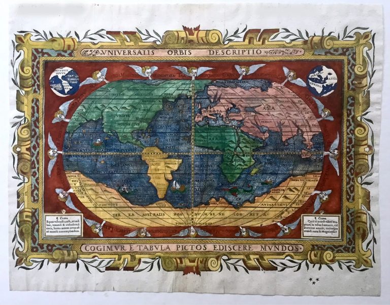
Universalis Orbis Descriptio
YEAR 1590
Technical data
World
1590
Johannes Myritius
28,0 x 39,0 cm