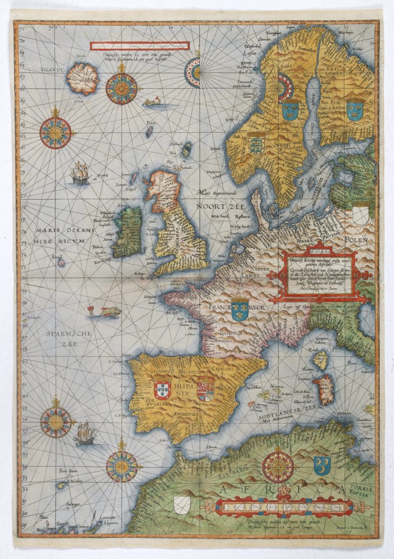
This is the earliest obtainable sea chart of Europe. It appeared in Waghanaers Spiegel der Zeevaerthe first printed sea atlas with charts and sailing directions assembled systematically in one book. The plates are engraved by Joannes Doetecum, perhaps the best engraver at the time.
The map was significantly larger than the other maps in the atlas, and is rare in good condition.
The map is embellished with compass roses, sea monsters, sailing ships, coats of arms and rhumb lines. West of Ireland is the mithical Island of Brazil, but he does skip the fictional Frisland, which was included on most masp at this time.
Iceland has an interesting shape and if too far to the North. The only thing right is perhaps the island Grimsey, North of the country. The map appeared in another state in 1592, where Iceland has been remade. What happened in the meantime was that Ortelius published his Islandia.