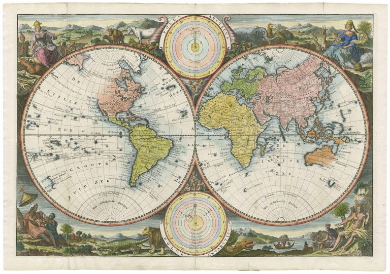
Double-hemisphere map of the world, surrounded by pictorial engravings allegorical of the four continents, with two spheres depicting the solar system; from a Dutch bible with text on the verso. The engravings surrounding the map are the same as those on the second world Bible map produced by Visscher, Orbis Terrarum Tabula Recens Emendata… (Shirley 431, 1663). Since that earlier iteration, the geography of the map evolved, to depicting California as an island back to its peninsular form, with more refined depictions of northeastern Asia, Korean and Japan, the Great Lakes in North America more correctly delineated, and South America more accurate. The northwest coast of North America is not mapped above Cape Blanco
[Untitled map of the world, from a Dutch Bible]
YEAR 1720
Technical data
World
1720
Hendrik and Jacob Keur
30 x 44,5 cm.