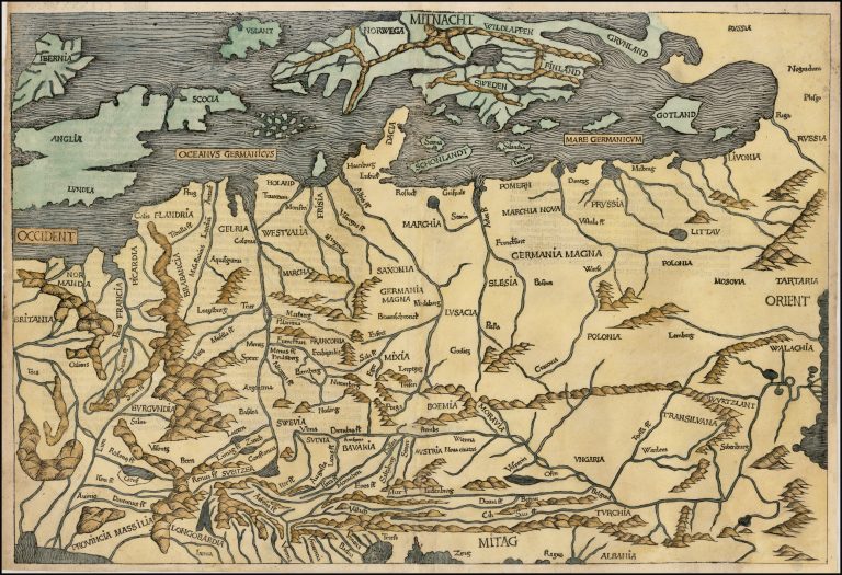
This is the second time Iceland appears on a printed map, authored by one Hieronymus Münzer. It is in 1493 in Hartmann Schedel ’s Liber Chronicum, or The Nuremberg Chronicle. This was a landmark in fifteenth-century printing. It appeared in Latin and German and was a huge commercial success. It was the first book not devoted to religion to use illustrations. And this was done on no small scale, with over 1,800 woodcut illustrations. The subject of the book was world history from its creation to the End of Days. The publisher was Hartmann Schedel. The maps in the book are often credited to him.
The map covers much of Europe, from the Black Sea to France and from the Adriatic to Scandinavia and Iceland. Scandinavia resembles that of the Ulm Scandinavia but Greenland, seemingly not having space North of Scandinavia, has been moved to the East! Iceland here does not look much like the country we know today and the only place name is Yslant. Haraldur Sigurðsson, describes it as looking like a leaf and speculates that the author might have had some intelligence about how interrupted Iceland‘s coast is with bays and fjords. The country is also much too close to Norway. The reason for this could be that Münzer confused the identity of Iceland and Thule.
[untitled, Northern and Central Europe]
YEAR 1493
Technical data
Northern and Central Europe
1493
Hartmann Schedel, Hieronymus Münzer
Hartmann Schedel
39 x 57,5 cm.