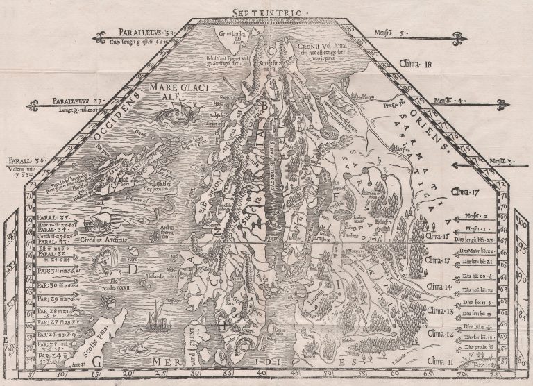
This folding trapeze-shaped map of the Nordics by Magnus was published in Basel, in his History of the Nordics. This is a really nice, visually appealing map with a unique shape. Geographically, it is a step backwards when it comes to Scandinavia but a leap forward in the case of Iceland. Langanes in the Northeast corner is a distinguishing feature and the West coast finally has a proper bay. The North coast is more rugged than the South. The ice at the Northeast coast is back from the Carta marina. However, Iceland is still far North of the Arctic Circle (which is approx. 66.5° N) and Greenland seems to have retreated all the way to the North Pole.
[untitled, Scandinavia]
YEAR 1567
Technical data
Nordics
1567
Olaus Magnus
35,6 x 52 cm.