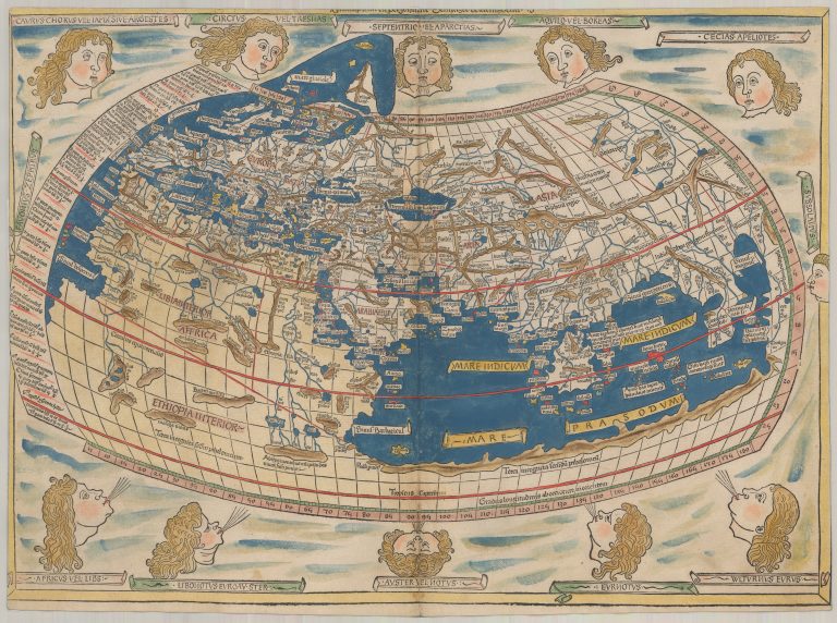
This is the World map of the Ulm publication of Ptolemy’s Geography, from 1482. In the same publication the Nordics appeared on a printed map for the first time. On the World map we see the Nordics breaking out of the previous world map, which didn’t extend much further than Britain. Iceland is shown on it in a shape that is not recognizable, but it is still there and is in roughly the right place, if perhaps a bit too far to the east. Unfortunately, the name there is not Islanda as on the Scandinavia map, but Scitlanda, likely a typo. Among other notable curiosities is the manner in which Scotland extends to the east. This was the conventional wisdom at the time, an error repeated on countless maps.
The map was likely made after the description of Nicolas Germanus Donis and the map is often credited to him. However, it is also sometimes credited to Johannes Schnitzer of Armsheim who was the woodcutter and actually signs the map with his name at the top margin.