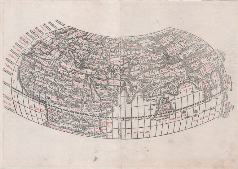
This map, from the 1511 edition of Ptolemy’s Geographia published in Venice, is unusual in being one of the first examples of two color printing. First the shape of the lands was printed in black and then the place manes in capital were printed with red.
The atlas/book also had a modern map, showing the latest discoveries. This map, based on Ptolemy, does though take into consideration some new information, such as the shape of the British Isles and Africa South of the equator.
To th eleft of the map are shown the climates and on the right zodiacal signs.