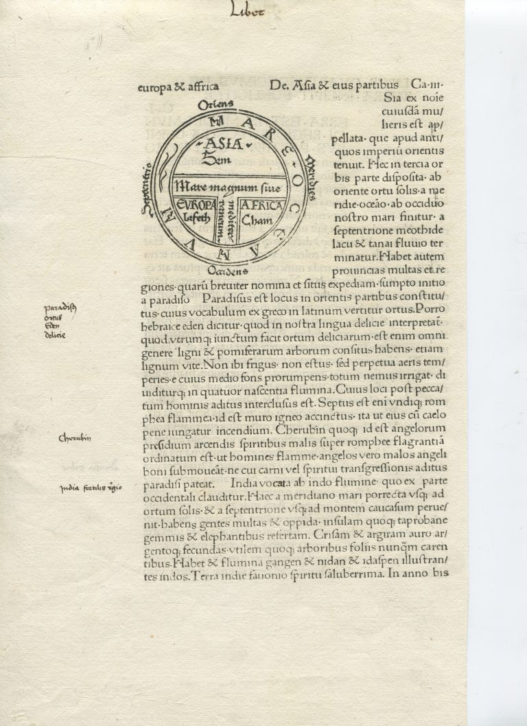
This is not only the first printed map of the world, but the first of any geographical represantetion to appear in a printed book, published in Augsburg, Germany in 1472. The map appears in Saint Isidore’s — the Bishop of Seville’s (560–636) — works, which are akin to an encyclopaedia of classical authors. The good bishop was compiling all knowledge worth keeping. Some forms of the same T-O map existed before the Bishop’s manuscript, e.g., the map was manually drawn before the advent of printing. The printed map was not drawn to show the true shape of the world, rather its purpose is conceptual; the map conveys that the world is primarily comprised of three known continents: Asia (at the top), Europe (on the bottom left), and Africa (on the bottom right).
Prior to the year 1000, surviving European maps of the world are exclusively limited to “T-O maps”, a name derived from the T dividing the landmasses within the O. Europeans had regressed more than 1,000 years in terms of geographical knowledge. Based on its importance to Christianity, rather than on the basis of geography, Jerusalem is located at the centre of the T-O map. In addition, scale does not seem to be understood, or more likely, deemed to matter. Yet, like the Babylonian World map and the Islamic maps, in the T-O map, the world is depicted as a flat disc that is surrounded by oceans, like the Babylonian and the Islamic maps.